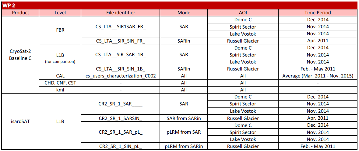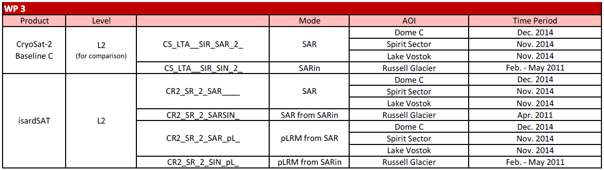
The SPICE project, based on the ESA products definition, deals with three different levels of data:
- FBR products containing unpacked L0 complex echoes that have been sorted and geo-located.
- Level 1B products includes the SAR averaged measurements (20 Hz), which have been geo-located, calibrated, azimuth processed and applied geometric corrections.
- Level 2 products contain geophysical parameters that have been extracted from the L1B waveforms.
The following tables list the products that are used within the different work packages of SPICE, also specifying the corresponding AOI (Area of Interest) and time period, the altimeter mode, etc.